Atlas of Elbrus glaciers
(coming soon)
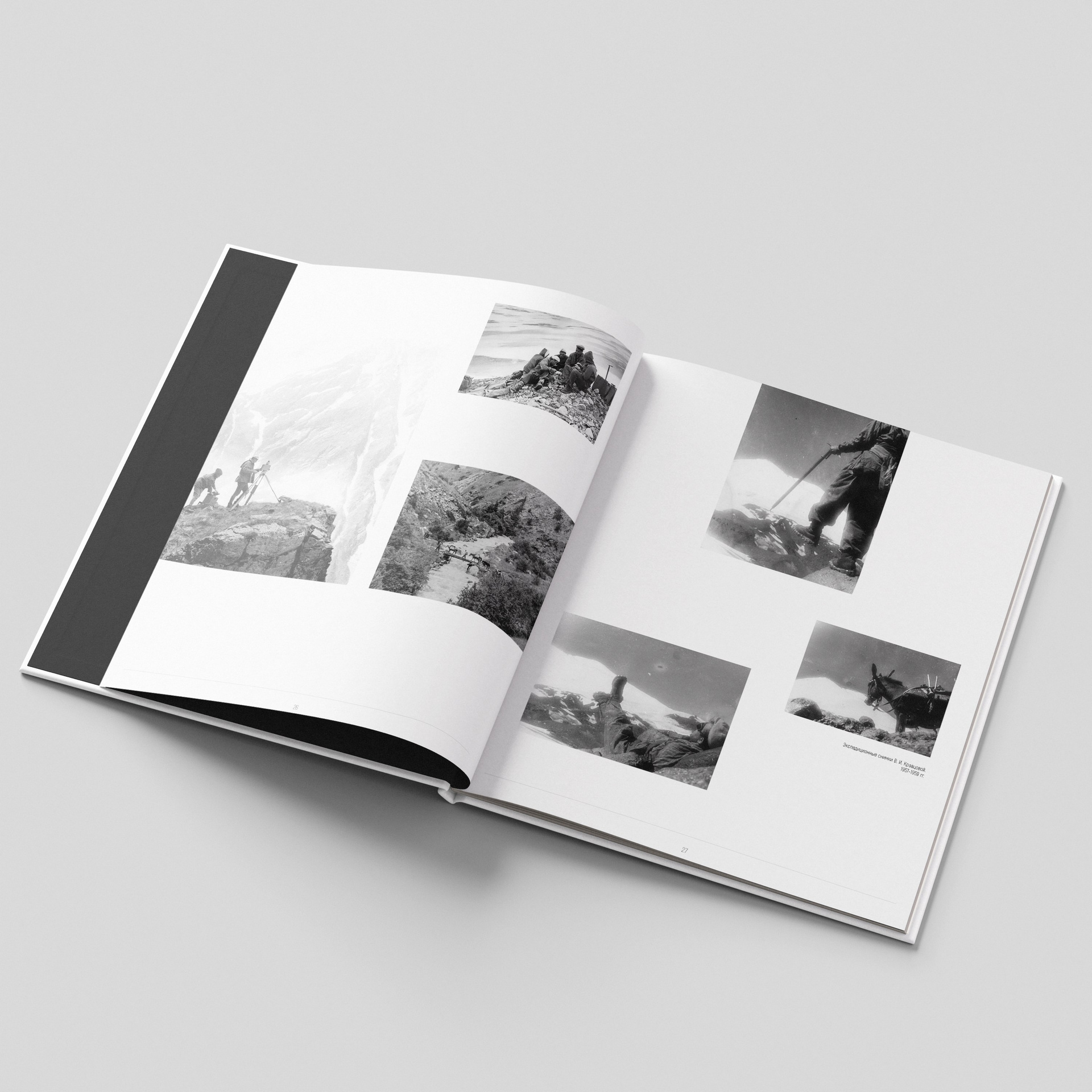
During the International Geophysical Year (1957–1958), the glaciers of Mount Elbrus (Caucasus, Russia) became the subject of systematic scientific research. An expedition by Moscow State University, led by Professor G.K. Tushinsky, conducted comprehensive glaciological studies using advanced methods of aerial photography and photogrammetry. A key role in these investigations was played by the Aerial Photomethods Laboratory, which enabled the creation of detailed documentation of the ice cover. The result of years of work was the Atlas of Elbrus Glaciers (1965), featuring photographic records of the glaciers' state from 1957–1960, along with specialized and general geographic maps. This work not only laid the foundation for further scientific inquiry but also became a unique visual record of mid-20th-century glacial conditions. Field studies and photography organized by A.V. Bryukhanov, included in the Atlas, covered the perimeter of Elbrus with detailed surveys of individual glacial valleys. Researchers traversed challenging mountain routes, documenting glacial changes from both ground and air.
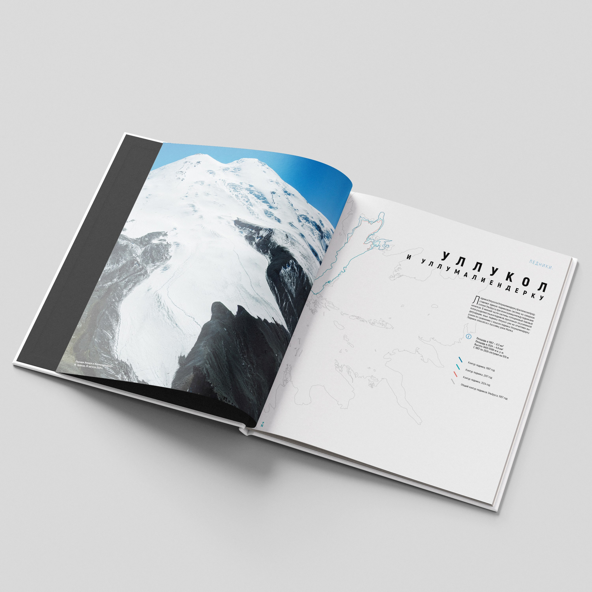
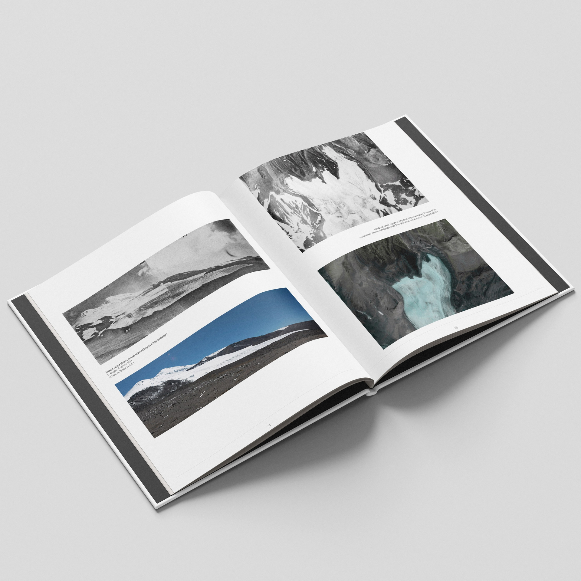
More than half a century later, in 2020–2022, a research team led by me conducted a repeat survey of Elbrus glaciers, meticulously recreating the routes of the 1950s–1960s expeditions. Using ground-based photography and drone aerial photography we recorded dramatic changes: significant reductions in ice cover, exposure of moraine deposits, and retreat of glacier fronts into higher elevations. Modern satellite imagery (2024), compared with archival materials, clearly illustrates the dynamics of glacial degradation. These findings form the basis of an updated atlas, continuing the legacy of early glaciological research.
Comparative analysis of multi-temporal glacier imagery is one of the most informative methods for assessing climatic changes. This approach not only quantifies the loss of ice area and volume but also visualizes landscape transformations for broader audiences. While numerical data remain crucial for science, side-by-side «before and after» imagery makes the issue of glacial retreat tangible and understandable even to non-specialists. In the case of Mount Elbrus, these materials hold particular value, documenting the rapid transformation of one of the Caucasus' key glacial systems.